<h4>Soil Moisture and Contaminant Plumes</h4>
An interesting presentation at a recent groundwater forum emphasised the importance of soil moisture in the distribution of contaminant vapour plumes particularly TCE.
<h4>Relevance to Adelaide today</h4>
This is of particular importance in Adelaide where numerous contaminated sites are being identified within or close to old industrial complexes.
<h4>Transport of TCE</h4>
The presentation showed how the TCE component is particularly resistant to biodegradation, compared to other hydrocarbons such as benzene. It is therefore able to pass through the groundwater from the source point, collect at the groundwater table, then continue toward the surface through the vadose zone as a vapour.
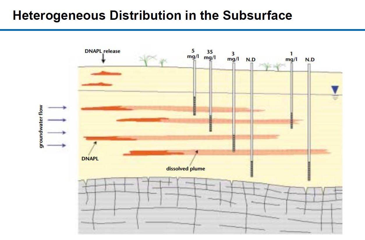
Furthermore, the presentation indicated a correlation between the moisture in the soil and concentrations of TCE vapour pathways.
<h4>Surface Geophysical Mapping of Soil Moisture</h4>
Surface Electro-Magnetic (EM) surveys are being used to map the soil moisture is contaminated areas, however as with any surface geophysical survey sooner or later the interpretations have to be “truthed” – meaning – drill a borehole and find out what is really there.
<h4>Borehole Testing</h4>
The common borehole testing for the investigation boreholes is to get a full core sample but with any sampling technique:
- What about core loss?
- As soil moisture is so important, how is the loss of moisture of drying of the sample between retrieving the core from the borehole to the laboratory handled?
The investigation boreholes seem to miss a real opportunity to maximise data by ignoring the benefits of geophysical borehole logging which is conducted “in situ” – where the contamination is.
<h4>Applicable geophysical logging techniques</h4>
Applicable geophysical logging techniques to measure soil moisture are:
- Induction/conductivity which uses the same physics as the surface EM surveys. The method can be used in investigation boreholes which have been cased with PVC casing.
- Neutron logging which directly measures the amount of hydrogen in the rocks. The majority of hydrogen is associated with water whether as water in pore spaces, bound into clay minerals of as moisture in either pores of clays above the groundwater table.
- Nuclear Magnetic Resonance (NMR) is a new logging technique becoming more popular because it can measure the water content of rocks directly and does not have the associated radioactive source requirement as neutron logging.
May be it is time for the local authorities to consider borehole geophysical logging to maximise data from contaminant investigations.