Geological Applications: Inter-Borehole Correlation of Target Properties
Knowledge of your target’s physical properties will aid in the selection of the most applicable geophysical logging method for your drill program.
As the project geologist, your desk studies on the most favourable drill targets have been completed, now you have to drill to increase the value of your company’s asset. You will have many competing processes to be undertaken in a timely and cost effective manner to increase your ore body knowledge. Most important will be the cost, keeping the drill rig moving (avoiding rig standby time) and preservation of your samples recovered from drilling (for geological assessment, transportation to the laboratory). Sure your drill program is planned and typically on a pattern, “battleship style”. Imagine what cost savings could be made if you are able to say (DURING THE DRILL PROGRAM):
- The target is not there anymore! Are we wasting drill metres? Do we need to drill deeper?
(Drilling deeper with the drill rig on site is much cheaper than bringing the drill rig back later)
- The target becomes larger and open in another area, we need to adjust our drill pattern in this area?
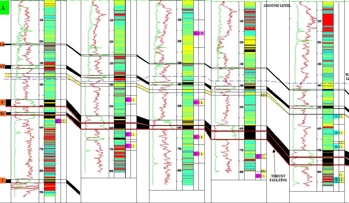
Let’s look at inter borehole correlation the ability to trace your target laterally away from one borehole to another borehole. You may be tracing the target itself, the property of the target’s host rock or the property of another horizon close to the target, which maintains geological synchronicity with the target, As a geologist you are looking for rock types which would be representative of quiet formational or depositional conditions which would be the same or similar at one given time over a large area. Clays are a good example of such conditions, so is volcanic ash. Both are common in the geological record and are good geological markers with distinctive geophysical log signatures.
- As a geologist, your only geological sample is from the borehole itself and is open to human error between individuals. Sure the geologist is highly trained and today there are good systems in place for sample description but do geologists all see the same thing? One of the more important geological sample descriptors is colour. As humans, do we all see the same colour?
The power of a repeatable, calibrated geophysical logging method is that the response can be distinctive to a geological feature. It is this distinctive geophysical log response and a human’s ability to use the eye to trace the geophysical log response (and any changes related to geological condition change) across a project area which makes geophysical log correlation a powerful tool.
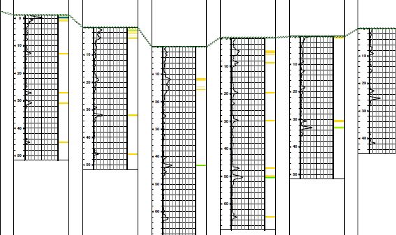
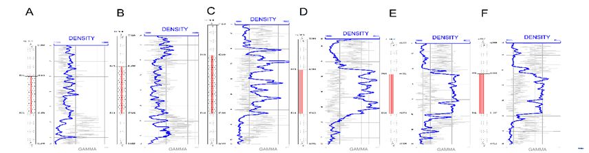
- The example above is from a line of boreholes across a project area. The gamma log peaks are associated with clay horizons. Immediately the geologist can see similar log responses occur at specific depths and can be seen in most if not all boreholes. Differences in the feature elevations in the boreholes suggest geological structure (in this case a syncline)
- Inter borehole correlations can be done manually by the geologist, but increasingly digital computer computations are being used for inter borehole correlations through data crossplots. The key here is calibrated, repeatable, precise geophysical log data.
- There are many different geophysical logs which can be used for inter borehole correlation, gamma is the most common but density, resistivity and induction-conductivity can all be associated with specific responses. In mature mining areas, such as the Pilbara region of Western Australia, a stratigraphy has been established based upon gamma log responses. Today this is used to guide regional geological interpretations, structural assessment and ongoing drill hole planning.
Geophysical Borehole Logging – Geological Intelligence for Ore Body Knowledge.